Latvia
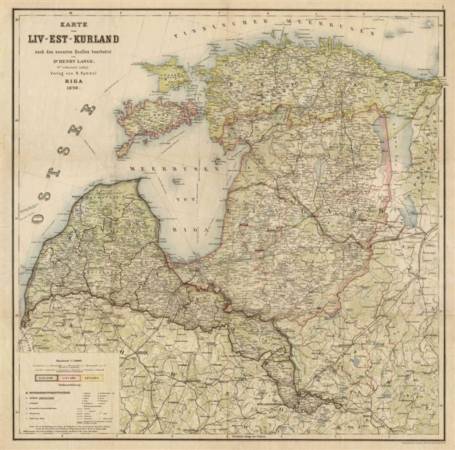
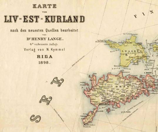
LatviaKarte von Liv-Est-Kurland 1898 (facsimile copy)
| Price (EUR): | 26.75 |
| Pages/Scale: | 1:750'000 |
| Language: | German |
| Country: | Latvia, Estonia |
| EAN: | 9789949423521 |
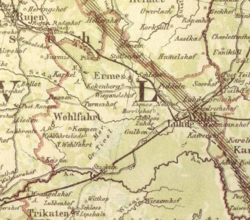
- The map displays the Baltic provinces according to administrative subdivision of the Russian Empire before 1917. It covers modern territories of Estonia and Latvia; modern Lithuanian lands are shown without southern and southwestern parts. Inner administrative subdivision of three provinces is shown with special symbol. Additional linear symbol displays a conventional boundary between residential areas of Estonian- and Latvian-native speakers.
- Geographical names are given in German for all population centres and geographical objects in three provinces. The part of modern Lithuania is named in old Polish language (German transcription).
- Detailed administrative subdivisions are marked, together with railways, maritime passenger lines, surface roads (with classification to 4 categories). Elevations shown in shading, no hypsographical marks. Additional symbols show castles, churches, factories, etc. Detailed display of areas covered with forests and marshes.
- The map was published and, probably, distributed by well-known publisher and bookseller N. G. Kymmel in Riga. The basic cartography belongs to Henry Lange (1821-1893); as the railway network is shown actual to later year, it should be considered that the map originals had been updated after his death
- The original preparation and printing was processed by Wilhelm Greve's lithographic factory in Berlin, which had long expierence with maps, albums and postcards.
- Scale 1:750'000, size 71.8 x 71.1
This product is not available in internet shop. About availability please contact us, or call +371 67 240 894