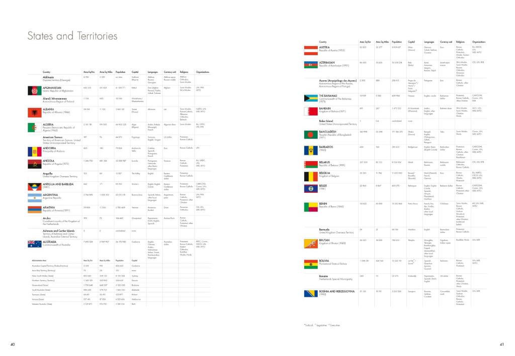
A comprehensive guide to the world’s states and territories including flags, capitals and key statistics is included. Making this an ideal reference atlas for home, school or office.
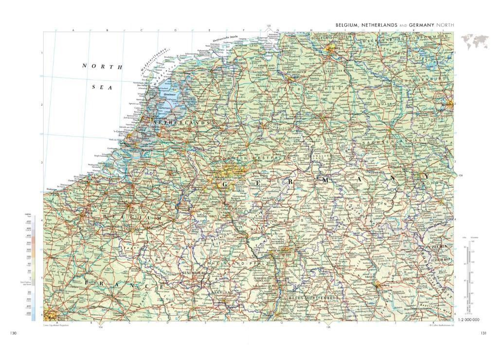
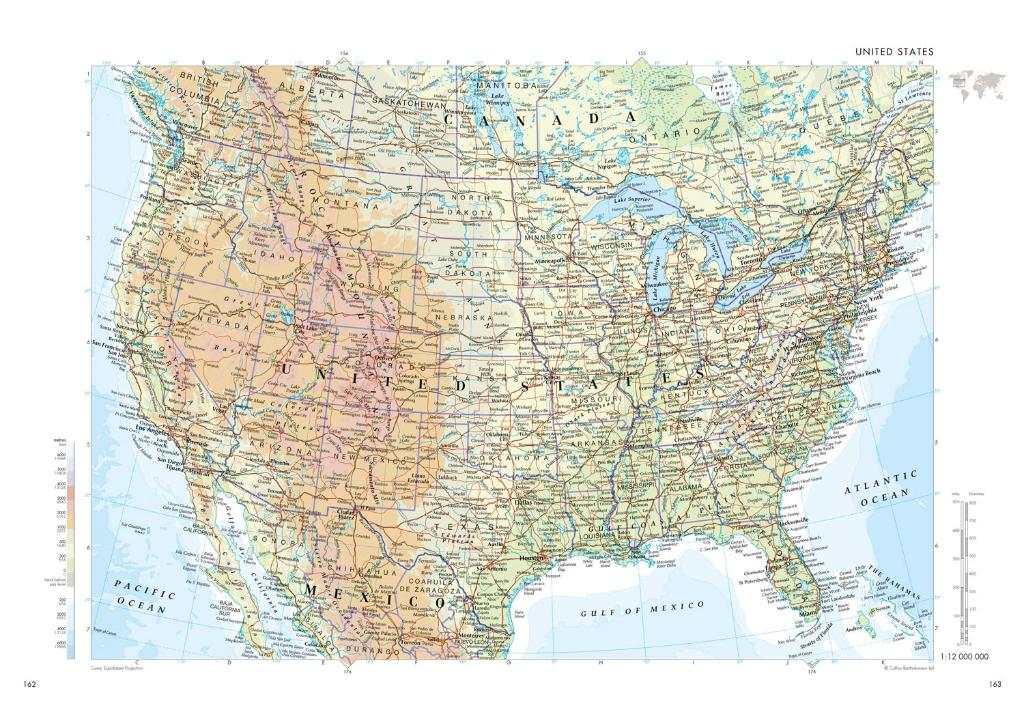
Authoritative mapping of the whole world
Plans of 46 of the world’s major cities
Geographical reference section with flags and statistics for the world’s states and territories
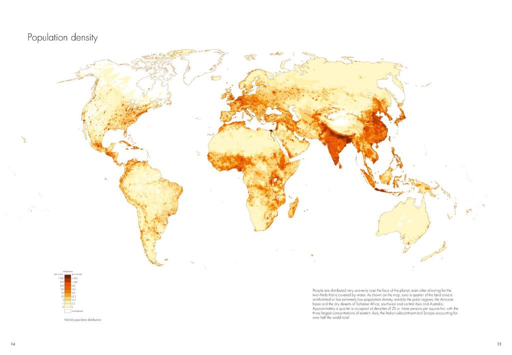
Maps and illustrations on major geographical themes, including earthquakes, population, cities, climate and migration
Historical mapping of the world from 1858 to the present day