Europe Postcode Map
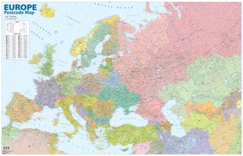
| Publisher: | Karšu izdevniecība Jāņa sēta |
| Scale: | 1:6'000'000 |
| Size: | 122 x 78,5 cm |
| Language: | English |
| Country: | Europe |
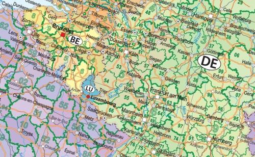
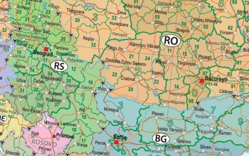
- There are all post delivery districts of every country in Europe shown on the map with appropriate post codes
- For countries which does not have regional division into post delivery districts one can find post codes of largest cities instead
- For the very first time there are post delivery areas pictured so detailed for Baltic countries, as well as the new post codes in Uzbekistan, Kazakhstan and other countries
- Map is supplemented with border points of entry and the main ferry lines.
Related Items:
| Image | Title | Category | Price | Buy | |
|---|---|---|---|---|---|
 |
Europe Postcode Map | Wall maps | EUR 14.90 | ||
 |
Europe Postcode Map (laminated) | Wall maps | EUR 24.05 | Out of stock | |
| Europe Postcode Map (2) | Page Nr. 1 no 1 | ||||