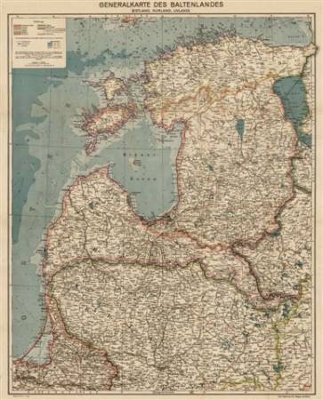
Generalkarte des Baltenlandes (Estland, Kurland, Livland) 1917 (facsimile copy)
| Price (EUR): | 26.75 |
| Pages/Scale: | 1:725'000 |
| Language: | German |
| Country: | Latvia, Lithuania, Estonia |
| EAN: | 9789949423514 |
- Generalkarte des Baltenlandes (Estland, Kurland, Livland), 1:725.000.Publisher: Carl Flemming AG, Glogau - Berlin, [1917] Edited by Kettler, J. I.
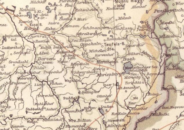
- The map displays the Baltic provinces according to administrative subdivision of the Russian Empire before 1917. In addition to the Baltic provinces, the map displays Eastern part of Ostpreußen, including Memeler-Land, i. e. it covers territories of modern Estonia, Latvia and Lithuania.
- Geographical names are given in German for all populated places and geographical objects. Detailed administrative subdivision, railways, no roads. Elevations shown in shading, no hypsographical marks.
- Edited by Professor Julius Iwan Kettler (1852-1921) from Weimar, who had been cooperating with Flemming's publishers for several editions.
- The map has no date mark. According to artwork and dating worked out by well-known Dutch researcher M. Witkam (http://www.atlassen.info), the map belongs to so called 4th generation [about 1920 - 1932] of 'Flemmings Generalkarten' being a collective name for several series of maps published by the Carl Flemming publishing company in Glogau, and by its successors: Flemming-Wiskott (Berlin) and Georg Westermann (Brunswick). However, printed fact of participation of J. I. Kettler, just Flemming's (not Flemming-Wiskott) logo at the lower right edge, railway network configuration and administartive boundaries lead to dating this issue as being drawn between 1916 and 1918.
- Scale 1:725'000, size 69,1 x 85,6 cm.